Best Beaches in Mauritius: Which Coast for Which Beach Day
Eight beaches compared by official sea frontage and airport taxi fare, and which coast to pick when the June to September trade winds blow.
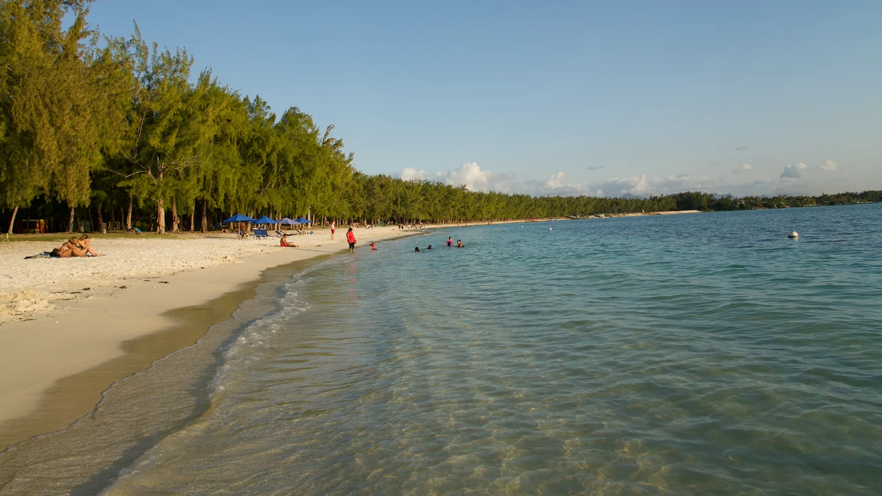
Pick the coast before the beach. From June to September the south-east trade winds hit the east and south hardest, according to the weather guide on Mauritius.com, a private travel portal, so for flat water in those months go west to Flic en Flac or north-west to Mont Choisy and Trou aux Biches. Le Morne, at the south-west tip, is the exception: it’s the kitesurfers’ beach, picked for that same wind. Belle Mare on the east is the long walk on the sand, with a breeze in any month; Blue Bay, 20 minutes from the airport, is the lagoon for a first or last day. Whatever the coast, a high-waves warning from Mauritius Meteorological Services means off the beach and out of the sea.
Eight beaches, one table
The airport taxi fares come from the official list effective from January 2026, which prices by hotel area, and add 10% if you pay by card. The frontage is the approximate sea frontage of the proclaimed public strip in the Beach Authority’s register (2025 list, read on 17 November 2026): it tells you how much public shore there is, not how many people you’ll share it with.
| Beach | Coast | Airport taxi, one way | Register frontage | Pick it for |
|---|---|---|---|---|
| Blue Bay | South-east | Rs 1,000, about 20 min | 400 m | Marine park lagoon, first or last day |
| Belle Mare | East | Rs 3,500 | 1,500 m | Long walk, a breeze |
| Mont Choisy | North-west | Rs 3,300 | 1,377 m | Casuarinas, a day on the sand |
| Trou aux Biches | North-west | Rs 3,300 | 700 m | Snorkelling in the lagoon |
| Pereybère | North | Rs 3,500 | 108 m | Shallow, calm water near Grand Baie |
| Flic en Flac | West | Rs 3,000 | 1,795 m | Sunset, evening in the village |
| Le Morne | South-west | Rs 3,500 | 1,000 m | The mountain, kitesurfing |
| St Félix | South | Rs 1,900 (village) | 819 m | A coastal walk; offshore currents |
The two longest strips on the table, Flic en Flac and Belle Mare, are where a walk along public sand runs to well over a kilometre, and the shortest, Pereybère at 108 m and Blue Bay at 400 m, are strips whose appeal is the water in front of them. Which base to sleep in on each coast is in the west coast and north coast guides, and the fares between coasts are in getting around Mauritius.
Blue Bay, the marine park near the airport
Blue Bay is the beach nearest the airport: Rs 1,000 by taxi on the 2026 list, about 20 minutes, which makes it the lagoon for a first afternoon or a last morning. The register’s public strip is 400 m of sea frontage, so the draw is the water, and you’ll want a lagoon more than a long walk. It’s a marine park, zoned with coloured buoys under the Marine Protected Areas Regulations, so swim and snorkel on the side your skipper or the beach signs point to. Snorkelling trips and the park rules are in the snorkelling, diving and dolphins guide.
Mont Choisy and Trou aux Biches in the north-west
Mont Choisy is the long beach: 1,377 m of register frontage, with white sand curving around a bay and casuarina trees behind it, in the tourist board’s description. It’s a beach to settle on for the whole day. It shares a taxi line with Trou aux Biches, Rs 3,300 from the airport on the official list, and the Grand Baie guide has both as the quieter, long-beach alternative to the village bay.
Trou aux Biches is the swim for snorkellers. The register lists three public strips there (700 m opposite the former aquarium, 215 m opposite Casuarina and 73 m in front of the police station), and the tourist board calls the lagoon good for snorkelling. Bigorno, the village dive centre, lists a snorkelling trip at Rs 1,200 a person on its 2026 tariff, 15% VAT included. Pereybère, about five minutes by car from Grand Baie, has the shallow, calm water that suits families; the north coast guide sets it against its neighbours.
Belle Mare on the east coast
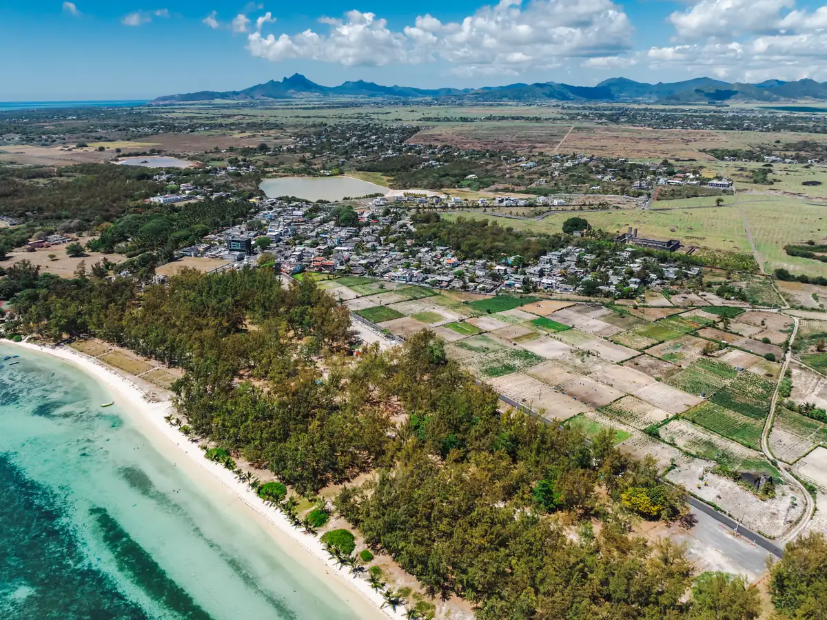
The tourist board’s page on the east describes beaches and lagoons alongside a cooling breeze and mentions relaxing under Belle Mare’s casuarinas. The register’s main strip is 1,500 m of frontage, the longest on this table apart from Flic en Flac, so it’s the beach for a long walk, and you don’t need a plan beyond it. The government’s climate profile describes the east as cooler and windier than the west, so expect a breeze at Belle Mare in any month and bring a layer; the before-you-go guide explains why the coast changes the season. A winter day here is more likely to be a walk than a long, flat swim.
If you’re staying in the east, the Île aux Cerfs guide covers the island outing from this coast.
Flic en Flac, with the evening nearby
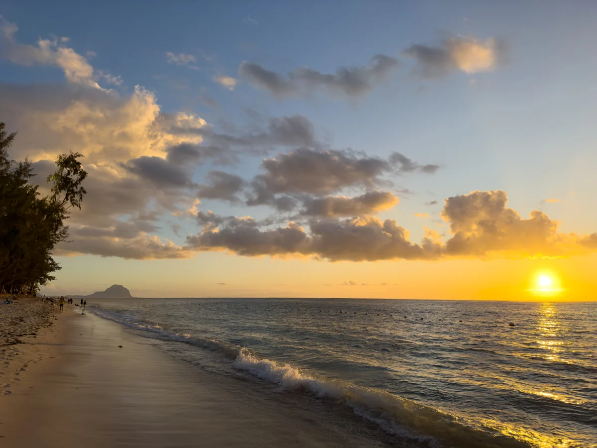
The register lists several public strips at Flic en Flac, and the longest, Wolmar near the Pearl Beach Hotel, is 1,795 m. The tourist board associates the west with sunset views, live music and beach bars, so the beach day runs straight into the evening: the sun sets over open water, and the bars and restaurants are a short walk from the sand, so you won’t need a second transfer after dark.
From the airport it’s 47 km by road and Rs 3,000 on the official taxi list; by bus it takes two, changing at Victoria Square in Port Louis. The west coast guide has the full comparison with Tamarin and Le Morne.
Le Morne, the mountain behind the beach
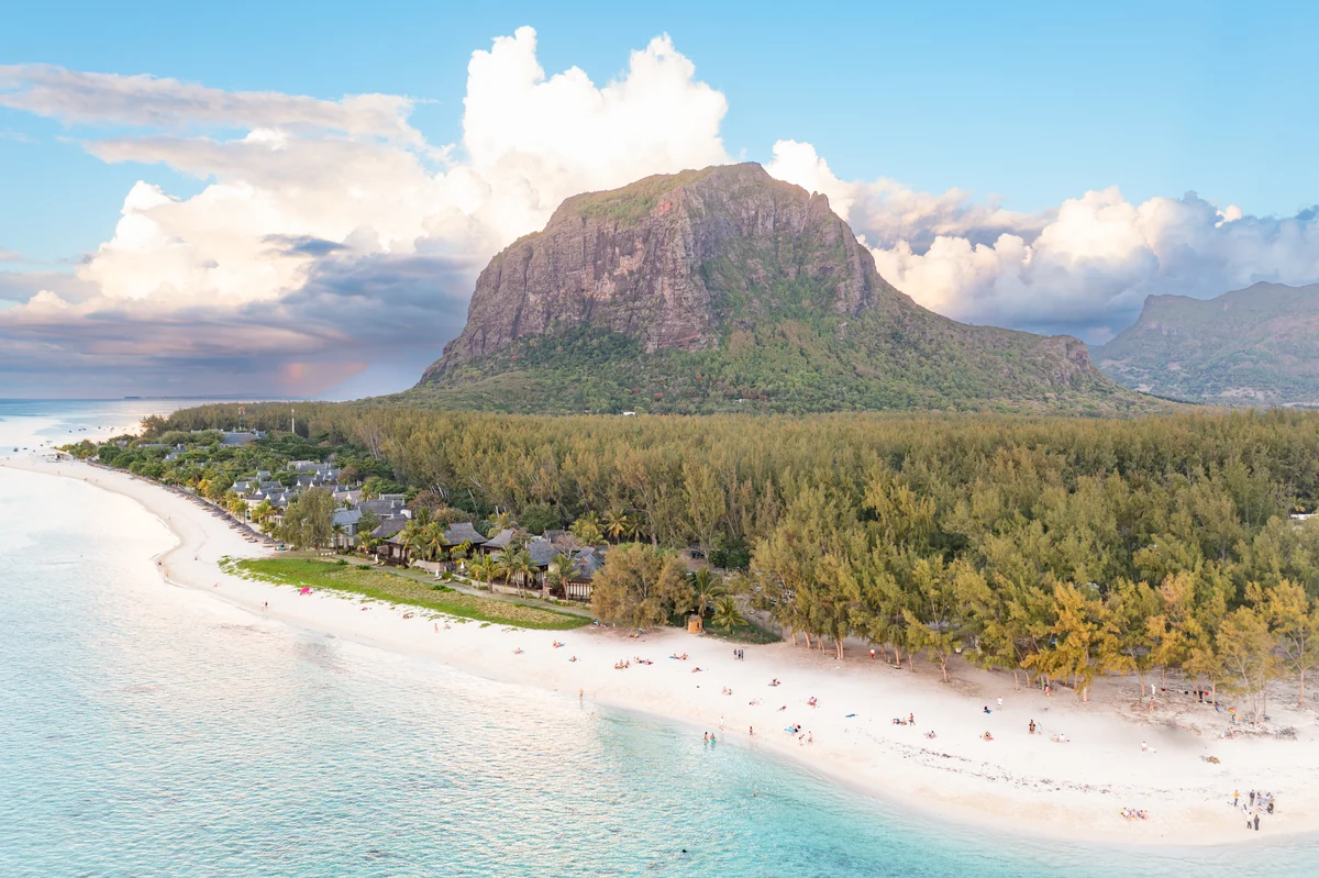
The tourist board places the beach at the foot of Le Morne and highlights the wind sports there; the register’s Le Morne Brabant strip has 1,000 m of frontage. The mountain is the reason to choose this end of the west coast: you’ll find yourself looking inland at the rock as much as out to sea. If someone in your party is learning to kite, ION CLUB Le Morne lists its centre as open 09:00-17:00 every day (read on 17 November 2026).
The south: cliffs at Gris Gris, currents at St Félix
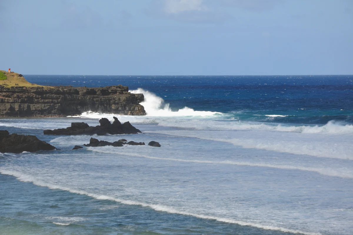
The south is the coast to visit for scenery, not for a flat swim. The tourist board’s page on the south describes waves crashing against volcanic rock cliffs, and the register lists Gris Gris as a public beach with 220 m of frontage, which is where the surf in the photo below breaks. St Félix, 819 m in the register, comes with the tourist board’s own warning: offshore currents and coral reefs mean entering the water is best left to experienced swimmers. Around Souillac the board points to Jardin Telfair, a garden with a coastal approach, for a picnic day that needs no swim. The taxi list puts Bel Ombre and St Félix at Rs 3,000 and 1 h to 1 h 20 min.
Public access and the high-waves warning
Every beach here is on the Beach Authority’s list of proclaimed public beaches (2025 list, read on 17 November 2026). The list covers the beach itself, not the hotel grounds beside it, so walk in by the public approach. If you’re driving between coasts, the car hire guide covers driving on the left and the excess.
When a high-waves warning is in force, Mauritius Meteorological Services tells the public to avoid the beach and the sea altogether. The swell behind the warning is raised far offshore, not by the local wind, so a still, sunny morning on your stretch of sand doesn’t mean the warning is wrong: that’s the day for Pamplemousses or Port Louis.
Read also

Things to do · 9 min read
Snorkelling, Diving and Dolphins in Mauritius: Prices, Rules
Updated · 17 November 2026First dive Rs 4,800 and Open Water Rs 30,000 at a Trou aux Biches centre (2026 tariff), plus the legal rules for dolphin boats: distance, hours, swimmers.

Before you go · 8 min read
Before You Go to Mauritius: Entry, Cyclones, Rupees
Verified · 17 November 2026UK, Canadian and EU visitors need no visa. Passport, travel form, cyclone season to 15 May, rupee rates and customs limit, checked 17 Nov 2026.

What to see · 7 min read
Black River Gorges: Which Walk, and Where It Ends
Verified · 17 November 2026Black River Gorges walks: the 14 km Machabée loop back to Pétrin, the strenuous 10 km trail to Lower Gorges and the easy 6 km Savanne return.

Car hire · 7 min read
Car Hire in Mauritius: Licence, Excess, Driving on the Left
Verified · 17 November 2026Car hire in Mauritius: daily prices from €24, excess of €400 to €1,000, licence rules for UK and Canadian drivers, and what driving on the left involves.